Topographic Land SurveyARIZONA SURVEYORS, INC.
A topographic survey is the collection of data to define terrain, roadways, visible utilities, buildings, vegetation and miscellanies hardscape features, that is most often utilized by Architects to design the location, size and form of buildings and Civil Engineers to perform flood studies, design roadways and infrastructure and to design features such as walls, bridges and culverts.
Other uses are the calculation of volumes of material and water retentions. A solid topographic survey is the base of any project. |
Topographic SurveysProcesses that are utilized in the data collection of topographic data are
Aerial Photography, Drone Technology, Laser Scanning, Lidar and Bathymetric. |
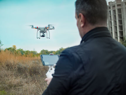
Aerial and Drone are simply flown over the site and data is collected through photography and then using specialized software the data is processed and a format is generated that can be imported into and AutoCad format and then the surveyor generates a finished product described in the above paragraph. This process is reliant upon ground control established by a surveyor that all parties use to keep the project congruent.
Laser scanning is the process in which a scanner is placed upon predetermined control points establish by a surveyor and the area is scanned into an image system inside of a cloud. The end process is similar to aerial and drone where the data is processed through special software imported to AutoCad and then completed. Lidar is the collection of subterranean locations of utilizes and is processed the same way as scanning and aerial. Bathymetric is the process in which equipment is connected to a GPS unit with special software, placed on a boat and driven back and forth across to water to record the underwater terrain. This is often done in mines to determine depth and available quantities of material. |
Topographic ReportingThe methods in which the data is collect varies in methods.
|
The traditional method in the collection utilizing GPS and Total Stations through a field controller that communicates with the instruments and the data is collected in method of points one at a time at each feature location.
Upon completion, the data is uploaded to a computer, processed and imported into an AutoCad program and then utilizing the information a map is generated showing the contours of the land, roadways, visible utilities, miscellanies concrete, pools, buildings, etc. whatever happens to be on the subject property. The product is then printed to either a hard paper copy or a PDF format and given to the client for their records and the AutoCad file is delivered to the Civil Engineer or Architect for the design process. The surveyor will determine whether a map will need to be filed at the county recorder’s office, state statute dictates this, however even if it is not necessary the client can request this done. | ||||||||||||


